

Description
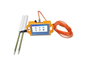
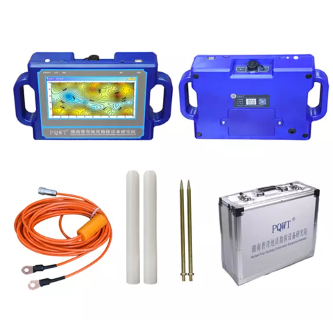
The PQWT-S500 500M Automatic Mapping Water Detector uses the Earth’s electromagnetic field to analyze underground geological structures and identify groundwater resources with over 90% accuracy.
It provides real-time geological mapping through automatic curves and profiles, helping users quickly locate aquifers, faults, and caves.
Ideal for use across plains, hills, mountains, plateaus, and basins, it determines well positions and depths on-site with one-key operation. Suitable for drinking water and irrigation projects, it supports English, Spanish, French, and Arabic, requires minimal training, and can be operated by just 1–2 people.
Comes with a two-year warranty and 24-hour professional support.