-
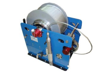
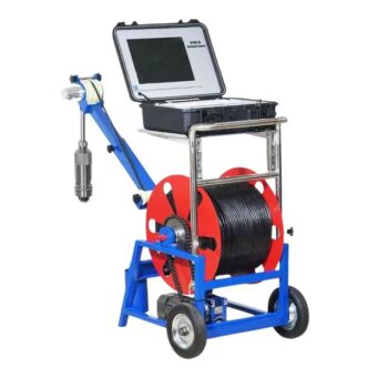
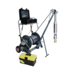
Request QuoteBrand: GOLDDJ SERIES LOGGING WINCH
Product Features:
- AC variable-Frequency Regulating Speed Technology that enables precise control of cable deployment, and retrieval.
- Dual mode Operation: Allows users to choose between automatic constant speed for consistent logging and manual speed control for operator flexibility.
- Intelligent depth management for automatic depth calculation:This enables real time tracking of probe position to ensure accuracy.
- Enhanced safety and control. It has a self-locking brake system that secures probe position during emergencies or pauses.
-
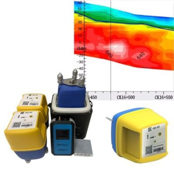
Request QuoteBrand: GOLDGD-1C Seismic Node
Product Features:
• High Sensitivity & Precision: Integrated digital sensors ensure accurate seismic signal detection.
• Wireless & Efficient: Cable-free design simplifies deployment and reduces operational costs.
• Durable Construction: IP-rated protection for use in rugged field conditions.
• Long Battery Life: Low power consumption for extended continuous recording.
• Flexible Applications: Ideal for 2D/3D seismic surveys, structural monitoring, and academic research.
• User-Friendly Software: Intuitive interface for setup, synchronization, and data retrieval. -
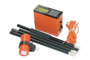
Request QuoteBrand: GOLDGD-5 Ultra Magnetotelluric System
Product Features
• Wideband Detection (DC–10 kHz): Delivers full-spectrum coverage for shallow and deep subsurface structures.
• High-Precision 32-bit ADC: Achieves crystal-clear signal fidelity with ultra-low noise and distortion.
• Multi-Mode Integration: Seamlessly supports MT, AMT, and CSAMT modes for flexible exploration needs.
• Real-Time Geological Imaging: View resistivity profiles, phase curves, and apparent resistivity instantly on-site.
• Rugged, Field-Ready Design: IP67-rated enclosure withstands harsh weather, dust, and impact.
• Ultra-Low Power Consumption (< 5 W): Ideal for extended field campaigns with minimal energy use.
• Precise Timing Synchronization (≤ 30 ns): Dual GPS and thermostatic crystal clock ensure timing integrity in all conditions.
• High Data Capacity & Fast Transfer: Built-in 64 GB storage with USB, WiFi, and Ethernet connectivity. -
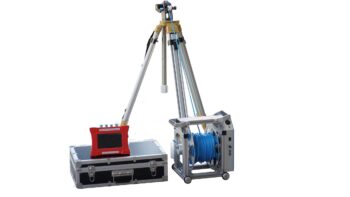
Request QuoteBrand: GOLDGD-C1201 FULL HOLE IMAGING SYSTEM
Product Features:
- Panoramic borehole imaging that captures continuous, full circumferences images of the borehole walls revealing bedding planes, fractures, lithological contacts, and structural features with exceptional details.
- Digital video and still capture offering both real time video streaming and high-resolution still image recording for post analysis and reporting.
- Depth-synchronized logging that authentically correlates image data with precise depth measurements for accurate geological interpretation.
- Robust downhole camera suited for high temperature, high pressure, and corrosion.
-
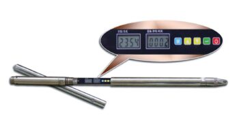
Request QuoteBrand: GOLDGDP-3D WIRELESS DIGITAL INCLINOMETER
Key Features
- Wireless and Bluetooth connectivity – enables seamless data transmission and real-time monitoring without cumbersome cables, enhancing field efficiency and safety.
- 3D orientation sensing – equipped with three magnetometers and three accelerometers for full spatial awareness and high-resolution directional data.
- Magnetic multi-shot surveying – captures multiple orientation points in a single run, ideal for complex borehole trajectories.
- High precision and stability – it is engineered for consistent performance in non-magnetic and weak magnetic formations, minimizing distortion and drift.
- Portable and user-friendly – It has a compact design and an intuitive interface suitable for varied field conditions and rapid deployment.
-
Request QuoteBrand: GOLDGDQ-2D DIGITAL INCLINOMETER
Product Features:
- Digital Accuracy – captures real-time inclination and azimuth readings with high resolution and stability.
- Non-magnetic compatibility – Ideal for use in formations where magnetic interference compromises traditional compass-based tools.
- Portable and Field ready – Lightweight, rugged design with intuitive interface for rapid deployment in remote or challenging terrain.
- Multi-drilling adaptability – suitable for hydrological, geothermal, mineral exploration, and geotechnical boreholes.
- Data Logging and transfer – Integrated memory and USB connectivity for seamless data export and post-processing.
-
Request QuoteBrand: GOLDGDQ-2D GEOPHYSICAL BOREHOLE LOGGING EQUIPMENT
Product Features:
- High resolution sensors for resistivity, seismic, IP, and magnetic measurements.
- Borehole cameras and loggers for visual inspection and structural analysis
- Modular design compatible with various probe types and depths
- Rugged construction for field reliability in harsh environments
- Intuitive design software for data visualization, interpretation, and reporting
-
Select optionsBrand: GOLDGYGD-IV Rotary Borehole Inspection Cameras Price range: KShs 921,200.00 through KShs 1,162,000.00
Technical Sheet
- Imaging Chip: 1/3” color CCD, sensitivity 0.1Lux.
- Display: LCD, 12 inches, resolution 1024*768.
- Lens: Manually fine-tune the focus; the lens is 360 degrees horizontally, tilted 180 degrees to rotate, freely controlled and can stay in any position.
- Illumination Unit: front LED patch lamp beads, the brightness of the light source is adjustable in 8 levels.
Measurement Depth: 300M, 400M, 500M, 600M, 800M, 1000M - Storage Unit: U Disk.
- Probe: Panorama/ rotation can be replaced at will, 40-120mm.
- Working Voltage: AC 220V50Hz.
- The tensile strength of the cable is 250kg.
- The maximum pressure of the probe is not less than 15Mpa.
-
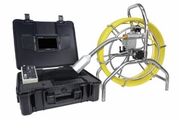
Request QuoteBrand: GOLDGYGD-V PUSH ROD INSPECTION CAMERA
Product Features:
- High resolution camera head for detailed visuals.
- Flexible push rod system allowing navigation through narrow and curved pipes.
- Waterproof and corrosion resistant ensuring reliable performance in tough conditions.
- Real-time video and image capture
- Distance counter and depth indicator that tracks insertion length for accurate location mapping
-
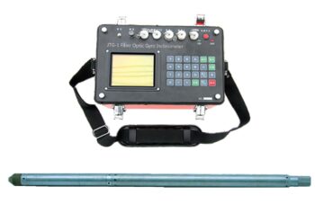
Request QuoteBrand: GOLDJTG-1 FIBER OPTIC NORTH-FINDER GYRO INCLINOMETER
Product Features:
- Multi-shot surveying – captures multiple orientation points in a single run, enabling detailed trajectory mapping deviation analysis.
-
Request QuoteBrand: GOLDWCZ Proton Magnetometer
Product Features:
- Proton-precession sensor for absolute total-field measurements
- Rugged, weather-resistant housing for field durability
- Large, readable display with clear numeric and status indicators
- Onboard memory for thousands of readings and time-stamped records
- GPS time/position tagging (optional) and USB/Bluetooth data transfer
- Long-lasting rechargeable battery with field-replaceable pack
- Lightweight carry case and mounted tripod/stand options
-
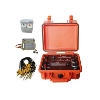
Request QuoteBrand: GOLDWDA-1 Super Digital Resistivity Meter
Product Features:
• Dual Functionality: Measures both resistivity and induced polarization (IP) with exceptional precision.
• High Power & Depth: Advanced signal processing allows deep penetration and stable readings even in complex terrains.
• Intelligent Design: Automatic data recording, self-calibration, and real-time display simplify field operations.
• User-Friendly Interface: Intuitive touchscreen display and simple menu navigation enhance operational efficiency.
• Reliable Performance: Excellent anti-interference capability ensures accurate measurements in various geological environments.
• Flexible Data Management: Supports USB data export and PC software for data processing, mapping, and reporting. -
Request QuoteBrand: GOLDWDFZ-9 Super Electric Multi-electrode Survey System
- Multi-channel operation: Simultaneous data acquisition from multiple electrodes speeds up surveys and improves data accuracy.
- Power: Strong current injection allows deep detection and reliable data in high-resistivity formations and challenging ground conditions.
- Intelligent control: Microprocessor-based system with automatic ranging, polarity switching, and real-time monitoring for safe, efficient operation.
- Precision: Digital filtering and noise reduction give stable, interference-free signals for accurate subsurface mapping.
- Flexibility and durability: Works with multiple electrode arrays (Wenner, Schlumberger, Dipole-Dipole, etc.) for resistivity and IP surveys, in a robust, weather-resistant build suited to field and laboratory use.
-
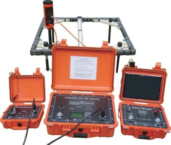
Request QuoteBrand: GOLDWTEM Transient Electromagnetic System
The WTEM Transient Electromagnetic Method System is an advanced geophysical exploration solution engineered for rapid, high-precision subsurface investigation.
Designed to integrate the best features of transient electromagnetic (TEM) technology worldwide, the WTEM system delivers powerful transmission, exceptional anti-interference performance, and reliable data quality in diverse field conditions, from shallow environmental mapping to deep mineral and groundwater exploration.
Applications:
• Mineral exploration (e.g., base metals, gold deposits)
• Groundwater and aquifer mapping
• Environmental and engineering geophysics
• Hydrocarbon and geothermal reconnaissance
• Railway and infrastructure subsurface surveys
-
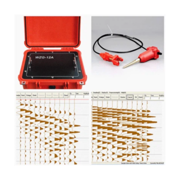
Request QuoteBrand: GOLDWZG-24/48C Engineering Seismograph Series
- Product: The WZG-24/48C is a 24/48-channel engineering seismograph with 24-bit digital technology for high-resolution seismic data acquisition.
- Applications: Surface wave analysis, seismic refraction and reflection surveys, shear wave velocity testing, pile integrity assessment, and micro tremor monitoring.
- Key features: Real-time waveform display, signal enhancement, noise reduction, waveform stacking, and flexible sampling options.
- Performance: Wide dynamic range and high sampling precision give reliable results even in challenging field conditions.
- Flexibility and uses: Supports 24- or 48-channel setups for projects from shallow site characterization to complex subsurface imaging, including infrastructure, groundwater, mining, environmental, and civil engineering work.